WINNIPEG — Manitoba's annual battle against spring flooding may not be too onerous this year, provincial flood forecasters said Wednesday.
The flood risk is low or moderate along most rivers, including the Assiniboine, Pembina, Roseau and Souris, due to low snowfall over the winter and low soil moisture when the ground froze.
The exception is the Red River, because of heavy snowfall upstream in North Dakota that is to soon melt.
"There's a lot of snow that happened about a month ago and they've had a number of systems since that time," Transportation and Infrastructure Minister Doyle Piwniuk said.
Some low-lying areas along the Red River south of Winnipeg could see flooding, but the water is not expected to rise enough to overcome community dikes and diversions, the province said in its March flood outlook.
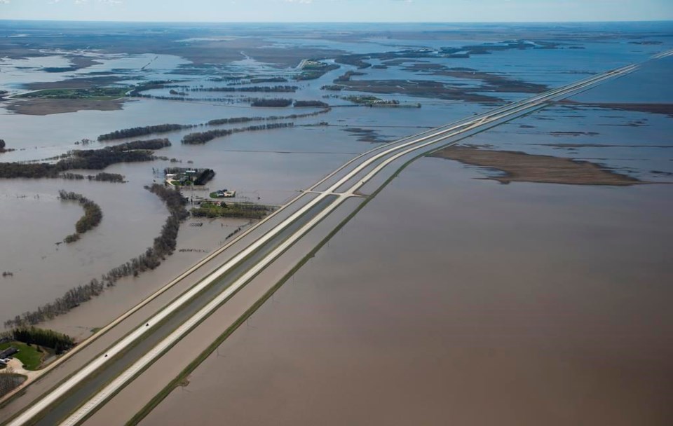
Highway 75 — the key link between Winnipeg and the United States border that often has some sections flooded — is likely to be spared this year, Piwniuk added. The highway is an important trade and tourism corridor, and spring flooding over many years has prompted closures and lengthy detours.
"I'm cautiously optimistic," said Mayor Scott Crick of Morris, a town that lies along the highway. Work is still underway on a multi-year project to raise a low-lying stretch of the busy route.
Manitoba often sees some areas flooded in spring as water rushes in from the south and west.
The province has built up a series of dikes, dams and diversions to protect communities. The biggest defence is the Red River Floodway, a massive ditch that diverts water from the river around Winnipeg. It is expected to be used this year, the province said.
Last year saw severe flooding in some areas north of Winnipeg. Some 2,000 people were evacuated from the Peguis First Nation as the Fisher River inundated the community.
About 900 are still unable to return, Amanda Lathlin, a legislature member with the Opposition New Democrats, said Wednesday.
The province is still in talks with the federal government about permanent flood mitigation for the community, Piwniuk said, and the risk of flooding in the area this year is low.
Provincial officials cautioned the flood threat could increase if the weather in the coming weeks becomes much worse than normal. Spring flooding is affected by a combination of several factors, such as how quickly the snow melts and whether heavy rain or snow falls at the same time.
This report by The Canadian Press was first published March 22, 2023
Steve Lambert, The Canadian Press


