Average has never sounded so good.
The forecast for September and even early October will be just that — temperatures will average in the high teens and low 20s, along with rain once every three days or so.
By and large, gone are the days of temperatures in the high 20s and low 30s.
“The weather pattern for the next five to 10 days is actually looking fairly good for fire weather and forecasting because of the cooler temperatures, the chance of precipitation,” Environment Canada meteorologist Lisa Erven told the Courier. “The caveat there is that the continued risks of thunder storms is quite strong.”
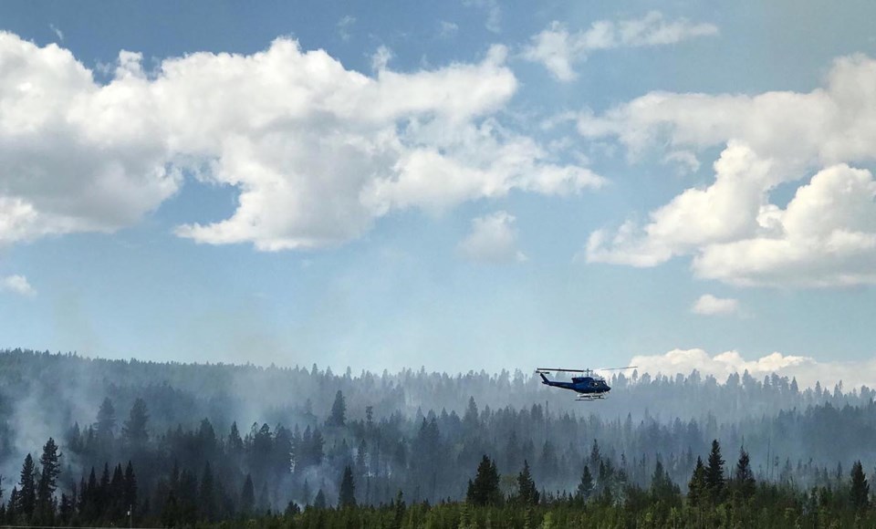
More than 500 wildfires were still burning across B.C. as of Friday morning. Though a change in wind can alter the situation dramatically, the air quality in Metro Vancouver is most impacted by three hot spots: fires on northern Vancouver Island, the Mount Hicks wildfire near Agassiz and a fire burning in Washington State’s Olympic Peninsula.
The Mount Hicks fire is by far the largest in close proximity to Metro Vancouver, and was 420 hectares in size as of Friday morning. Two fires near the Village of Zeballos on Vancouver Island are covering 428 hectares.
Should Metro Vancouver issue more air quality advisories in the coming days, it’ll likely be a result of fires on Vancouver Island and the westerly winds coming off the Pacific Ocean.
Those same wind patterns are the ones that typically flush out smoke and bring clean, ocean air.
“What we’ve been looking for is westerly winds, winds coming directly from the west, to try and blow everything off to the east,” said Metro Vancouver air quality analyst Kyle Howe. “This year has been a little more challenging because we haven’t had as many pathways to get clean air into the region then what we would normally expect.”
This year has been the worst on record for air quality in Metro Vancouver, as 21 advisories have been issued. The 14-day span of continuous advisories from Aug. 13 to 26 is also a new benchmark. Close to 1.3 million hectares of forest have burned since April 1, which is also record setting. Fire suppression costs alone are already north of $360 million.
The 30-year temperature average at YVR airport for September is 18.9 C, while the daily average is 14.9 C. Erven said those numbers could fluctuate between half a degree to one degree this month.
A change in temperature alone, however, is far from being the lone factor affecting wildfires: how much rain falls and where it falls, lightning strikes, humidity levels and wind patterns also play a part.
Speaking to the Courier from the Provincial Wildfire Coordination Centre in Kamloops, fire information officer Ryan Turcot said forecasting the long-term outlook of the current fire season can’t be done for at least another month. He added that it’s not uncommon for some fires to burn into October and November.
“If we do in fact see warm conditions that could potentially have implications on the fire season for the larger fires of note that we’re responding to, particularly the ones up north,” Turcot said. “That could mean that they burn for a bit longer.”
Metro Vancouver’s most recent air quality advisory happened on Aug. 27. Howe expects prolonged stretches of hazy days are now in the rear view mirror.
“The next 10 days will be quite pleasant I think, but we’re not talking about the heat that we were seeing earlier this year that coincided with those big wildfire smoke impacts that we were seeing,” Howe said. “I think that we are in a pattern that will keep the air relatively clean for our area.”


