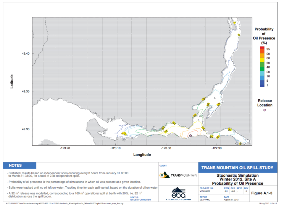
Kinder Morgan's 15,000-page facilities application contains some interesting information on what an oil spill in Burnaby would look like, according to a report by Stantec Consulting. Click here to read the full report.
The map isn't showing up in high resolution in the photo above, but if you open the report and go to page 87, you can see the original and zoom in. That's just one of several maps.
The report is full of interesting info, including current soil and water assessments around the terminal. Check out the summary and conclusions if you want a quick snapshot.


